
Installing navigation software on a Mac laptop transforms your machine into a powerful marine charting station, allowing you to plan routes, monitor conditions, and integrate real-time data from onboard electronics without dedicated hardware. The process typically takes 30 to 60 minutes and requires matching your macOS version to software compatibility, configuring network connections for chart updates and instrument integration, and validating data feeds before departure.
Modern marine navigation applications designed for macOS have closed the performance gap with traditional dedicated plotters. Professional mariners and serious cruisers now rely on laptop-based systems as primary or backup navigation tools, particularly when properly integrated with AIS transponders, radar, GPS receivers, and autopilot systems through NMEA 0183 or NMEA 2000 networks. The key advantage lies in screen real estate and processing power. A 15-inch laptop display provides more chart detail than most fixed plotters, while desktop-class processors handle complex weather overlays, routing calculations, and simultaneous instrument monitoring without lag.
Success depends on three factors: selecting software that supports your specific chart regions and instrument protocols, establishing reliable power and mounting solutions for the marine environment, and verifying data accuracy before you rely on the system offshore. Unlike mobile apps designed for casual use, professional navigation software for Mac requires deliberate setup. Chart libraries must be downloaded or licensed, instrument interfaces configured with proper baud rates and sentence filtering, and backup procedures established for chart updates and waypoint databases.
The following guide walks through every step, from assessing your current marine electronics infrastructure through final verification of chart display and data integration. You’ll have a working, professionally configured navigation system that meets the standards expected in commercial and serious recreational maritime operations.
What You’ll Need to Set Up Navigation Software on Mac
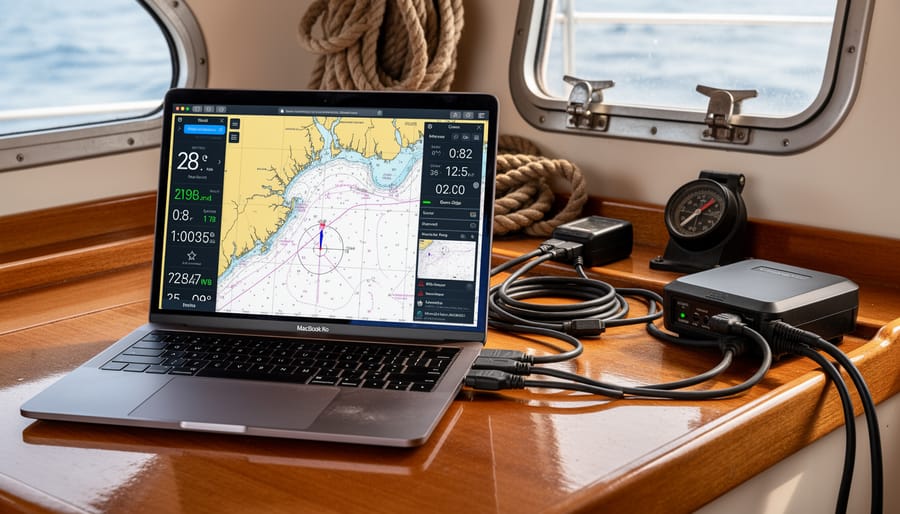
Before you begin the installation process, gather the necessary components to ensure a smooth setup and proper integration with your vessel’s electronics. Having everything ready saves time and prevents installation delays once you’re committed to the process.
Your Mac needs to meet specific baseline requirements for reliable navigation software performance. Most modern navigation applications require macOS 11 (Big Sur) or newer, though some professional packages demand macOS 12 or later. Verify your system has at least 8GB of RAM, 16GB is preferable if you plan to run radar overlay or advanced weather routing features simultaneously. Storage demands vary significantly: budget 20-50GB for the application and basic chart sets, but larger chart libraries covering multiple regions can consume 100GB or more. An Intel or Apple Silicon processor from 2018 onwards typically delivers adequate performance, though M1 or newer chips handle complex rendering tasks more efficiently.
- MacBook Pro or MacBook Air (2018 or newer recommended) with macOS 11 or later
- USB-to-serial adapter (FTDI chipset preferred for reliable NMEA 0183 connections)
- GPS receiver: USB puck-style or serial GPS with marine-grade antenna
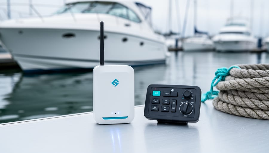
- NMEA multiplexer or WiFi gateway for multi-instrument integration
- Chart subscription or perpetual license for your cruising regions
- External SSD or high-capacity USB drive (minimum 128GB) for chart storage and backups
- NMEA 2000 interface cable if connecting to N2K backbone
- Marine-grade power adapter or inverter rated for your Mac’s wattage requirements
- Ethernet cable for wired network connections to WiFi gateways or routers
- Backup GPS device or handheld chartplotter for redundancy
Beyond the hardware checklist, secure your chart data sources before installation. Most navigation software requires separate chart purchases or subscriptions, these aren’t bundled with the application. Research which chart providers cover your intended cruising grounds and verify compatibility with your chosen software. NOAA charts for US waters are free but require downloading, while commercial providers like Navionics or C-MAP offer subscription models with automatic updates.
For vessels with existing NMEA 2000 networks, you’ll need an interface device that translates between N2K and USB, Actisense NGT-1 is the industry standard, though several manufacturers offer compatible alternatives. NMEA 0183 connections typically work through USB-to-serial adapters, but verify the adapter uses genuine FTDI chips rather than counterfeit versions that cause driver conflicts on macOS. If your instruments broadcast over WiFi, ensure your gateway supports the protocols your navigation software expects, whether that’s TCP, UDP, or proprietary formats.
Pre-Installation Safety and System Considerations
Before you begin installation, complete a full system backup of your Mac to external storage or cloud service. Navigation software installation rarely causes issues, but preserving your existing data protects against any unexpected complications during setup or hardware integration.
When integrating your laptop into onboard power, verify that any DC-to-AC inverter or power supply provides clean, stable voltage within Apple’s specifications. Marine electrical environments introduce noise and voltage fluctuations that consumer electronics aren’t designed to handle. Use a quality marine-grade power inverter with proper grounding to the vessel’s common ground point, never to through-hulls or randomly available metal fixtures.
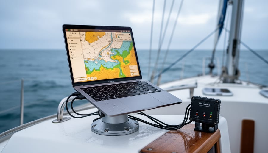
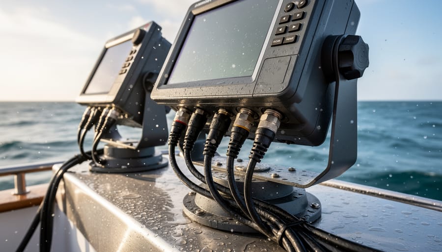
Consider your installation’s physical environment carefully. Saltwater spray, condensation, and shock loads pose constant threats to laptops designed for office use. Mount your Mac in a location protected from direct spray, with adequate ventilation to prevent overheating. If the helm station or nav area experiences regular water intrusion, you need waterproof enclosures or dedicated mounting solutions rather than simply setting the laptop on a table.
Your laptop becomes part of the vessel’s critical navigation equipment once integrated with GPS, chartplotters, and autopilot systems. This demands the same redundancy mindset you’d apply to any essential system. Just as you wouldn’t sail without an emergency tiller when systems fail steering don’t rely solely on laptop-based navigation without backup paper charts, handheld GPS, or a standalone chartplotter.
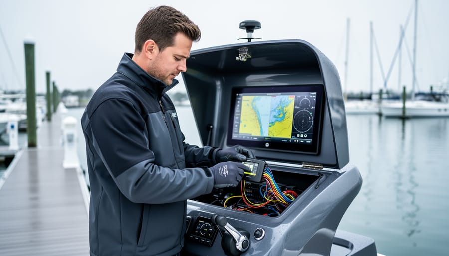
Stop and seek professional assistance if you encounter unfamiliar marine network protocols, if your vessel has complex existing NMEA installations with multiple devices, or if integration requires modifications to through-hull fittings or primary electrical panels. Excellence in marine electronics means knowing when specialized expertise prevents costly mistakes.
Selecting the Right Navigation Software for Mac
Chart Coverage and Data Sources
Charts form the foundation of your navigation software, and understanding the types available helps you choose coverage that matches your cruising plans. Modern navigation applications support two primary chart formats: raster and vector. Raster charts are digital photographs of traditional paper charts, preserving familiar appearance and detail but consuming more storage and processing power. Vector charts use mathematical data to render features at any zoom level, offering customizable display options and smaller file sizes. Most Mac navigation software handles both, letting you layer formats based on preference and available data.
Chart sources divide into official hydrographic office products and commercial alternatives. NOAA charts cover U.S. waters without subscription fees, while UKHO Admiralty charts require licensing for British and many international regions. Official charts provide authoritative, regularly-updated data but may lack the detail commercial providers add through field surveys and crowdsourced corrections. Commercial chart packages like Navionics, C-MAP, and others bundle global coverage with features such as community edits, 3D bathymetry, and integrated marina information.
Evaluate coverage by mapping your intended cruising grounds against each provider’s regional offerings. Subscription models vary: some charge annually per region, others offer perpetual licenses with paid updates, and a few provide free official chart downloads. Download charts while connected to reliable internet before departure, as marine WiFi rarely supports large chart updates underway. Verify your selected software supports automatic updates or plan manual refresh cycles to maintain chart currency.
Integration Capabilities with Marine Electronics
When evaluating navigation software for Mac, compatibility with your vessel’s existing electronics network determines whether you’ll achieve true integration or just add another isolated display. Start by mapping your current network architecture. NMEA 2000 backbones require software with native N2K support that can interpret PGNs (Parameter Group Numbers) from multiple device types. NMEA 0183 systems need software capable of parsing multiple sentence types simultaneously, not just basic GPS strings like GGA and RMC, but also depth (DBT), wind (MWV), and AIS (VDM) data.
Autopilot control represents the most demanding integration test. Software must support bidirectional communication to send course changes and waypoint information while receiving autopilot status feedback. Verify whether the application handles your specific autopilot protocol, whether Raymarine SeaTalk, Simrad AP commands, or NMEA autopilot sentences (APB, RMB). One-way compatibility gives you display-only functionality; two-way lets you actually steer from your laptop.
Radar overlay capability requires software that can process radar data streams, whether analog radar via dedicated interfaces or digital radar through Ethernet connections. Check supported radar brands explicitly; many Mac applications work with Furuno and Garmin but not Raymarine or Simrad systems.
AIS integration should handle both Class A and Class B targets, displaying collision warnings and target information overlaid on your charts. Engine monitoring depends on whether your engines broadcast data via NMEA 2000 or proprietary networks like J1939. Quality software will decode parameters like RPM, temperature, fuel flow, and pressure without requiring separate gateway devices.
Test compatibility before purchase using trial versions. Real-world verification beats marketing claims, especially for older marine electronics where protocol implementation varies significantly between manufacturers and firmware versions.
Step-by-Step Installation Process
Download and Install the Navigation Application
Begin by visiting the software developer’s official website, never download navigation applications from third-party sites or app stores unless explicitly recommended by the publisher, as this ensures you receive authentic, unmodified software with full vendor support. Locate the Mac version download link and check the system requirements against your macOS version (found under Apple menu > About This Mac) to confirm compatibility before proceeding.
Download the installer package, typically a .dmg file, and verify the file size matches what the vendor specifies. Open the downloaded file and drag the application to your Applications folder, or launch the installation wizard if provided. macOS may prompt you to authorize the installation, allow this by entering your administrator password.
Once installation completes, launch the application for the first time. Most navigation software requires immediate activation: have your license key ready if you purchased a perpetual license, or log in with your account credentials for subscription-based products. Enter your vessel information during initial setup, as some licenses are tied to specific boat registrations. The software may download additional components or update chart databases at first launch, ensure you have stable internet connectivity and adequate disk space for this process.
Configure Initial Software Settings
Open your newly installed navigation software and locate the preferences or settings menu, typically found under the application menu on Mac or within a dedicated settings icon. Start by entering your vessel’s critical parameters: overall length, beam width, draft, and maximum speed. These measurements directly affect route planning algorithms, especially depth safety calculations and estimated arrival times.
Next, configure display preferences for your cockpit or navigation station environment. Adjust color schemes for night vision compatibility, set chart detail levels, and configure data overlay positions so instrument readings don’t obscure critical chart features. Choose your preferred units of measure, nautical miles versus kilometers, feet versus meters for depth, ensuring consistency with your other instruments.
Set up backup intervals for automatic waypoint and route saving, typically every 5-10 minutes. Create a baseline settings profile and export it to external storage immediately. This backup proves invaluable if you need to reinstall or migrate to another Mac.
Finally, disable automatic software updates and power-saving features that could interrupt navigation during passage. These settings establish a stable foundation before connecting any hardware.
Connect GPS and NMEA Hardware
Plug your GPS receiver into the Mac using a USB cable or USB-to-serial adapter. Most modern marine GPS units offer USB connectivity, but older NMEA 0183 devices may require a serial adapter with proper driver installation. Once connected, open your navigation software and navigate to the device or hardware settings panel.
Select your GPS from the list of available ports. On macOS, these typically appear as /dev/ or similar designations. If your device doesn’t appear immediately, check System Settings to confirm macOS recognizes the hardware, and install any required drivers from the manufacturer’s website.
Configure the communication parameters to match your GPS output. Most marine GPS receivers transmit at 4800 baud for NMEA 0183, though some newer units use 38400 baud. Set the data bits to 8, parity to none, and stop bits to 1. Your navigation software should display incoming NMEA sentences once properly configured.
For NMEA 2000 networks, connect through a gateway device that converts the CAN bus protocol to USB or WiFi. These gateways typically require minimal configuration, automatically detecting instruments on the network. Configure your software to receive PGNs from the gateway’s IP address if using WiFi, or select the gateway’s USB port for wired connections.
Enable all relevant data sources in your software settings, including position, speed, heading, depth, wind, and AIS if available. The software should begin displaying live instrument data within seconds of proper connection, confirming successful data flow from your marine electronics to the Mac.
Load and Activate Chart Data
Start by locating the chart management or chart catalog interface within your navigation software, typically found under Settings, Charts, or a dedicated Chart Manager menu. Most applications separate chart installation from activation, so you’ll first download the chart databases for your cruising regions from the software provider’s servers or load them from external media if you’ve purchased physical chart cards.
After download completes, activate the regional chart sets by entering your license keys or selecting the areas covered by your subscription. The software will verify your credentials and unlock the appropriate chart layers. If you’re working with multiple chart sources, say, NOAA charts for U.S. waters and commercial charts for the Caribbean, set display priorities so the most detailed or most current charts appear by default when zooming in. This prevents lower-resolution charts from obscuring better data.
Configure automatic updates if your software offers that feature, ensuring you receive corrections and new editions without manual intervention. Set a schedule that runs updates while docked with reliable internet access. Always verify chart currency by checking the edition date and ensuring critical navigational aids match your most recent notices to mariners before departing for unfamiliar waters.
Integrate with Existing Marine Electronics Network
With your software configured and charts loaded, integrating your Mac into the vessel’s existing electronics network unlocks powerful capabilities like real-time instrument data overlay, autopilot control, and AIS target tracking. Start by identifying your network architecture, NMEA 2000 systems require a gateway or interface device (such as an Actisense NGT-1 or Yacht Devices adapter) that connects via USB to your Mac and to the backbone’s T-connector. For NMEA 0183 networks, a multiplexer consolidates multiple instrument outputs into a single data stream your Mac can read through a serial-to-USB adapter.
Once physically connected, return to your navigation software’s connection settings. Add a new data source, select the appropriate interface (USB device or network protocol), and set parameters matching your hardware, typically 250 kbps for NMEA 2000 or the instrument’s baud rate for 0183. Enable two-way communication if your software supports output; this allows the Mac to send waypoints to your chartplotter or commands to your autopilot. Autopilot NMEA 2000 setup requires careful configuration to ensure safe operation and proper message formatting.
Test the integration by verifying that instrument data, depth, wind speed, heading, appears correctly in the software. Check that AIS targets populate on the chart and that any output functions respond as expected. Document your configuration settings for future reference and troubleshooting.
Verify Installation and System Performance
With software installed and hardware connected, systematic verification ensures your Mac navigation system performs reliably before departing the dock. Start by checking GPS position accuracy: compare the latitude and longitude displayed in your navigation software against a known reference point, such as your berth coordinates from marina documentation or a handheld GPS unit. Position should stabilize within 10 meters for standard GPS receivers, often much tighter with WAAS or DGPS corrections enabled.
Confirm chart alignment by zooming to maximum detail around your current location and verifying that marina structures, docks, and shoreline features match reality. Misaligned charts or incorrect datum settings create dangerous navigation errors. Check that your software displays the correct chart edition and update date, outdated charts miss newly charted hazards and depth changes.
Test NMEA data integration by observing live instrument feeds in your software’s data panel. Depth sounder readings should update in real time and match your dedicated display. Wind instruments, if connected, should show current speed and direction. Engine monitoring data, when integrated, provides RPM and temperature readings that confirm two-way communication across your network. A comprehensive verification includes confirming your vessel safety backup systems remain functional and independent of the new laptop installation.
Run through this verification checklist methodically:
- GPS position matches known coordinates within acceptable accuracy range
- Chart imagery aligns with visible landmarks and marina features
- NMEA data streams display live updates from depth, wind, and speed instruments
- AIS targets appear on chart with vessel names, courses, and CPA calculations
- Backup navigation systems remain operational and accessible
If AIS integration is configured, nearby vessels should populate as labeled targets with vector lines indicating their course and speed. Create a test waypoint and route, then verify the software calculates distance, bearing, and estimated time of arrival correctly. Trigger any alarms, such as anchor watch or proximity alerts, to confirm audible warnings function.
Common installation issues typically stem from incorrect baud rate settings for serial NMEA connections or USB driver conflicts. If position data fails to appear, verify the GPS receiver shows as a recognized device in Mac system preferences and that the software input configuration matches the hardware output format. Missing chart display often indicates incomplete downloads or licensing activation failures requiring re-authentication with the chart provider.
Optimizing Your Mac Navigation Setup for Marine Use
Once your navigation software is running reliably, fine-tuning your Mac’s settings ensures consistent performance during extended passages and varying conditions at sea.
Start with power management: disable sleep mode entirely when running on shore power or a reliable marine power system. Navigate to System Settings > Battery (or Energy Saver on older macOS versions) and set both “Turn display off after” and “Prevent automatic sleeping” to appropriate settings. For underway operation, consider setting the display to dim after 10 minutes rather than turn off completely, this preserves screen longevity while maintaining situational awareness during night watches.
Adjust screen brightness for daylight readability, particularly if your Mac will be used in an exposed cockpit or flybridge. Maximum brightness drains battery quickly, so test various levels in actual sunlight to find the minimum effective setting. Enable Night Shift or install a third-party dimming utility for red-light mode during night passages, preserving crew night vision while monitoring charts.
Create redundancy in your navigation setup. Keep a current backup of all chart data, waypoints, and configuration files on external storage secured in a waterproof case. Many experienced mariners maintain a second laptop or tablet loaded with identical charts and waypoints, treating their Mac as the primary system while keeping a proven alternative ready, similar to maintaining backup steering options in case primary systems fail.
Weatherproof your installation even if the Mac remains below deck. Condensation and salt air corrode electronics rapidly. Use desiccant packs in the laptop storage area, and consider a waterproof keyboard cover if operating in the cockpit. Never leave the Mac exposed on deck during weather or when the vessel is unattended.
Run chart updates and system backups weekly during active cruising, and before any extended passage. Test your backup navigation system quarterly to ensure it remains functional when needed.
Common Questions About Mac Navigation Software
Can Mac navigation software communicate with NMEA 2000 and NMEA 0183 networks?
Yes, most professional Mac navigation applications support both NMEA 2000 and NMEA 0183 protocols through appropriate hardware interfaces, typically USB adapters for NMEA 0183 or dedicated gateway devices for NMEA 2000 networks. The key is selecting interface hardware with Mac-compatible drivers and ensuring your chosen software explicitly lists these protocols in its specifications.
Will navigation charts work offline on my Mac?
Modern navigation software allows you to download chart packages directly to your Mac for fully offline operation, which is essential for offshore passages beyond cellular coverage. Always verify during installation that your required chart regions are cached locally and update them before departing, as underway satellite internet bandwidth may be insufficient for chart downloads.
How does Mac navigation software performance compare to dedicated chartplotters?
Mac laptops often provide superior processing power and larger, higher-resolution displays than dedicated multifunction displays, making them excellent for passage planning and detailed chart work. However, dedicated chartplotters offer ruggedized construction, sunlight-readable screens, and reliable operation in harsh marine environments, factors that make hybrid systems combining both technologies increasingly common aboard serious cruising and commercial vessels.
What backup strategy should I implement with laptop-based navigation?
Never rely solely on a laptop for navigation. Maintain redundant systems including a dedicated chartplotter or handheld GPS, paper charts for critical passages, and regular backups of your navigation software configuration to external drives. This redundancy philosophy extends beyond electronics to include steering redundancy and other vessel safety systems, backup plans prevent inconvenience from becoming emergency.
Beyond these common questions, Mac users should recognize that navigation software requires ongoing attention to updates and maintenance. Unlike static dedicated chartplotters, laptop-based systems benefit from, but also depend on, regular macOS updates, security patches, and software version upgrades. Schedule these updates while dockside with reliable internet, never immediately before departure, as compatibility issues occasionally arise requiring troubleshooting time.
Integration limitations do exist with Mac navigation setups, particularly when connecting to older marine electronics manufactured before USB became the standard interface. Serial-to-USB adapters work reliably for NMEA 0183 data streams, but some legacy proprietary protocols from specific manufacturers may require Windows compatibility layers or simply won’t function on macOS. Research your existing equipment’s compatibility thoroughly during the selection phase rather than discovering limitations after purchase. The investment in proper interface hardware and verified-compatible software pays dividends in reliable operation and seamless data sharing across your integrated marine electronics network.
Installing navigation software on your Mac laptop transforms it into a versatile, integrated element of your marine electronics network. When installed correctly, your laptop provides powerful charting capabilities, real-time instrument data integration, and sophisticated route planning, all while working seamlessly alongside your existing equipment.
The key to success lies in thorough verification. Before relying on your new setup underway, confirm that all data sources are flowing correctly, charts display accurately at various zoom levels, and integrations with autopilots, AIS, and other instruments function as expected. Test the system in controlled conditions before trusting it offshore.
Remember that any navigation system, regardless of sophistication, requires regular backups and redundancy. Schedule periodic chart updates, maintain current backups of waypoints and settings, and never eliminate your backup navigation methods. Your laptop-based solution should enhance your navigation capability, not replace fundamental prudence.
For complex installations involving multiple NMEA networks, radar integration, or custom hardware configurations, professional installation ensures optimal performance and reliability. Expert integrators bring experience that prevents costly mistakes and delivers systems that work correctly from day one. Excellence in marine electronics installation isn’t just about functionality, it’s about confidence and safety when you’re offshore and conditions matter most.